Save remote layers
ℹ️ Updated to qgis2fds 1.0
This wiki page describes how to save remote layer data to local storage.
The layers you added to the Layers panel of your project while working on the Quickstart example are just links to remote data repositories.
If your network connection is down or the remote server is offline, that data becomes unavailable. Furthermore some servers have a limit on the amount of data that you are allowed to download.
To prevent such issues, you can download the required portion of the remote layer data to your local storage.
Right-click on the layer name in the Layers panel and choose Export > Save as. In the Save Raster Layer panel:
- set the saved data filepath to a convenient location;
- choose the extent of the saved data, a little larger than your presumed working area to stay on the safe side;
- leave the layer resolution as it is.
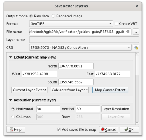
When you click OK, the requested data is downloaded and a new layer is created.
After that you need to set the appearance of the new layer, as you did with the remote layers in the Quickstart example.
Note that it is not allowed to save OpenStreetmap or Google Maps tiles to your local storage.