FAQ
ℹ️ Updated to qgis2fds 1.0
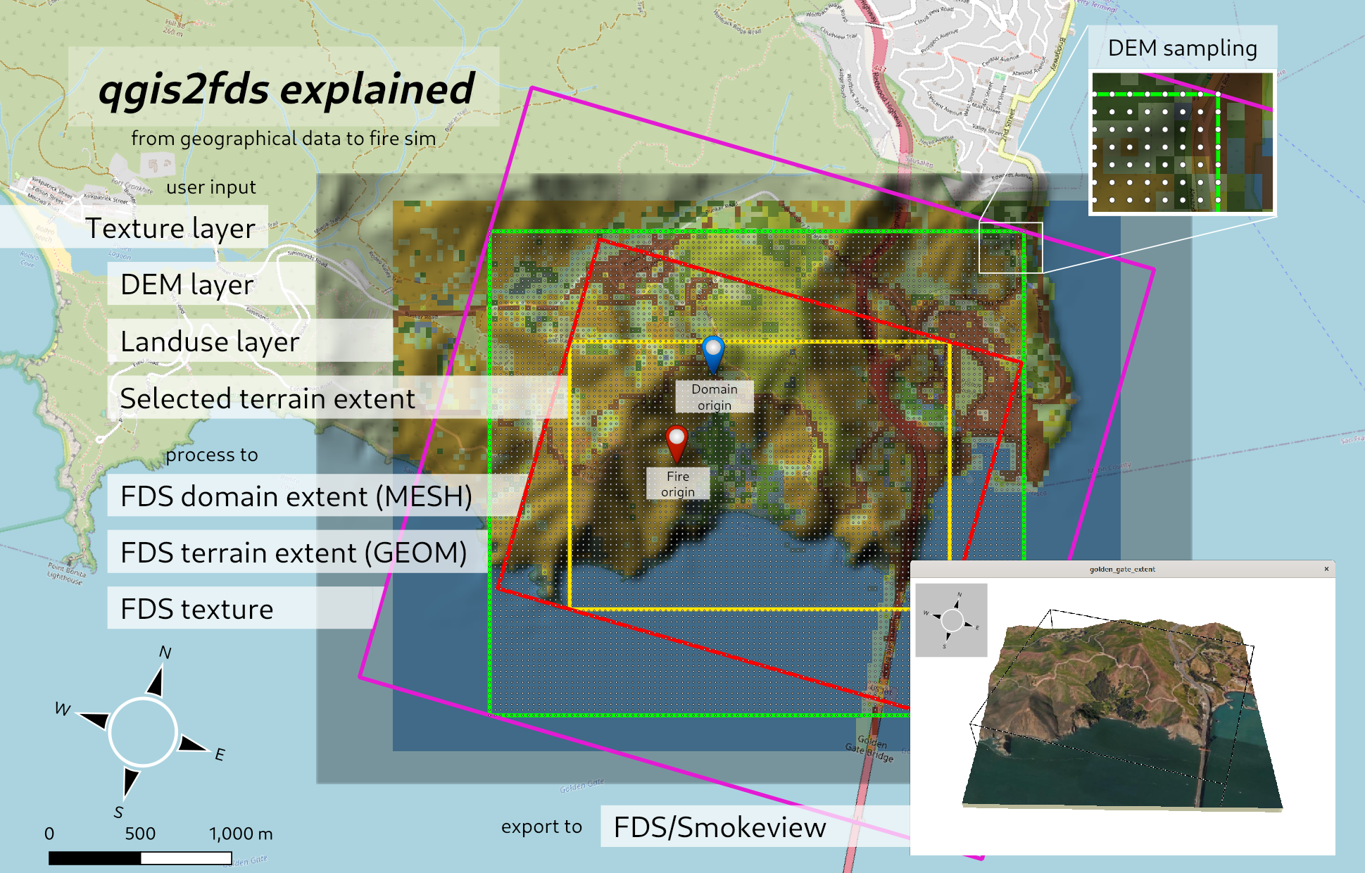
This wiki page contains the most frequently asked questions on qgis2fds.
The goals of the qgis2fds algorithm are the following:
- the FDS domain y-axis should point to the North direction;
- the final CRS should be metric and minimize distortion at a local scale (100km), all over the world;
- the FDS terrain (GEOM) should completely cover the FDS domain (MESH);
- the terrain geometry should precisely match the digital elevation model data;
The first two goals are obtained by transforming the user CRS to to the locally optimized UTM CRS. The third goal is reached by exporting an FDS terrain extension that is sligthly larger than the user selected FDS domain. The fourth goal implied creating a sampling grid perfectly matching the DEM data; but thanks to the new DEM interpolation feature, this requirement is now much less stringent.
As the user CRS (used for the original terrain DEM) and the new UTM CRS (used for the exported domain) are likely different, the exported FDS terrain (GEOM) may be larger and rotated compared to the FDS domain (MESH).
The following picture shows the way these goals are reached.
The user sets nmesh, the maximum number of FDS MESHes, depending on the hardware that is going to run the simulation in parallel.
If the domain sizes are xd and yd meters long, the number of MESHes along the x and y axis nmesh_x and nmesh_y are calculated like this:
r = xd / yd
nmesh_y = round(sqrt(nmesh / r))
nmesh_x = int(nmesh / nmesh_y)
The actual number of exported FDS MESHes is then:
nmesh_x * nmesh_y <= nmeshAnd their base shape is as squared as reasonable.