
Theta provides OpenAthena™, free and open source software which allows common drones to spot precise locations quickly:

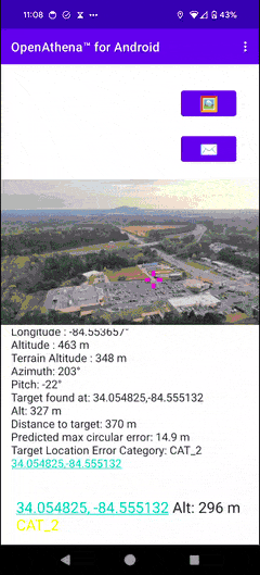
Theta's flagship platform OpenAthena for Android allows operators of COTS drones to obtain a precise location from any pixel of a single drone image.
Operators may instantly obtain the exact location of any selected point within a drone image, providing actionable insights faster. Target resolution is accomplished by combining the sensor metadata automatically embeded in drone images (containing data such as lat/lon, camera angle, and zoom level) with an offline-ready Digital Elevation Model which stores the altitude of terrain. This unique approach allows instant location analysis using just one drone image, no need for time-consuming mapping or processing!
The app's custom data extraction technique supports most DJI, Skydio, Autel, and Parrot aircraft. It includes a database of over 45 camera models and automatically accounts for factors such as roll/pitch/yaw, position, crop, focal length, lens distortion, and optical and digital zoom. The geodesy-based target resolution engine then simulates a raycast for the selected point towards a digital twin of the Earth to give you the precise coordinates of your selected point within the image. The engine precisely accounts for latitudinal variations and the curvature, rotation, and gravity of the Earth.
The app natively supports latitude/longitude, NATO 1m, 10m, and 100m Grid Refs, CK-42 lat/lon, and CK-42 Gauss Krüger Grid Ref as output modes.
-
All data processing occurs offline and requires no networked API calls. This keeps your data private and secure.
-
All the source code which defines how the app operates is open source, meaning anyone can inspect it.
-
Signed builds and a secure software supply chain built entirely from source preclude manipulation by bad actors.
OpenAthena for iOS is available for users of iPhone® and iPad® products:
https://github.com/Theta-Limited/OpenAthenaIOS

This version of the software is perfect for commercial drone users! It includes a system which automatically downloads an elevation model for your selected drone image. The app also supports downloading map areas for later offline use.
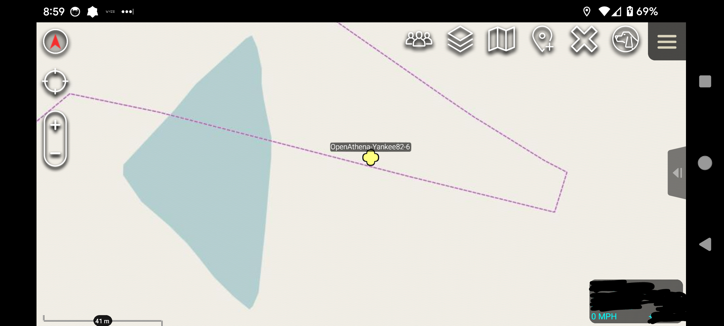
The OpenAthena apps support seamless integrations with platforms such as the Android Team Awareness Kit using the industry-standard Cursor on Target (CoT) interchange format:
OpenAthena for Android is entirely free to use, and is licensed under the GPLv3.0 to protect your rights as a user. You have inalienable rights to view the source code of the App and/or modify the App to your own specifications. You may (subject to local and international law) distribute the App with any modifications you have made, provided that you give your users the very same rights.
Let us help you accomplish your mission. Establish direct contact with our developers through [email protected].
Feedback from users is our single most valuable asset. Become involved with our development on GitHub, or submit feedback to [email protected] to shape the future of the project.